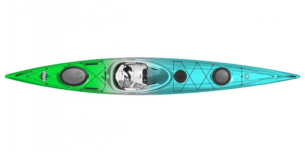
HYDRA 145 CORE WhiteOut
Like a sea monster from the deep, the Hydra possesses plenty of attitude and can certainly hold its own in the big stuff.
Learn More
Like a sea monster from the deep, the Hydra possesses plenty of attitude and can certainly hold its own in the big stuff.
Learn MoreJoin the Wave Sport Email Community
Be in the know about all things Wave Sport. We'll keep you up-to-date with our latest news, product info, team activities, events and new releases!
We are lucky as paddlers to live in the Columbia River Gorge. During the rainy season, within a half hour drive it is possible to be at over a dozen different rivers. Each and every one, unique, and awe-inspiring.
One of my favorite rivers in the gorge is actually a creek – Trout Creek, a tributary to the Wind River, located near Carson, WA.
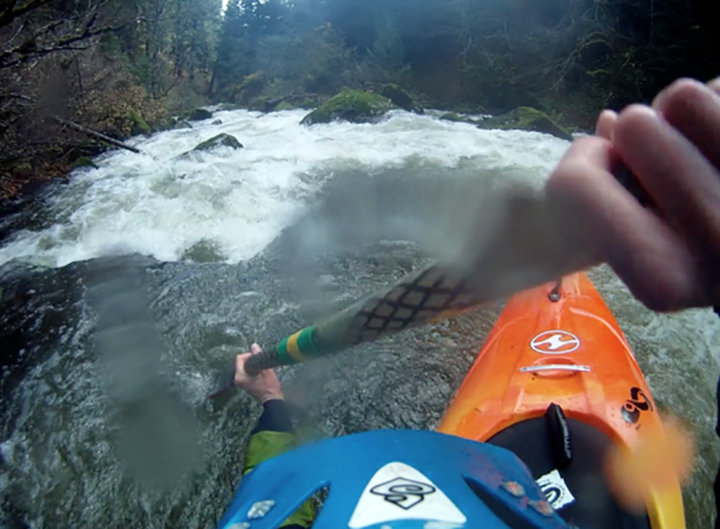
A 194 fpm, class V classic, Trout creek is full of 2.5 miles of steep, continuous, technical, Class V boulder gardens, and is challenge to catch with water. It requires a few days of heavy rain or snowmelt, however, with a put-in elevation near snow-line, many times the road is covered in snow when there is water in the creek. It’s a bit of a guessing game whether or not there is snow on the road, but worth it if you can make it to the creek.
The take-out: The gauge rock can be seen bottom right (Photo: Bryon Dorr)
In general, Trout Creek can be run anywhere from 150-600 cfs, and takes between 25 minutes and 2 hours to paddle, depending on the group. The visual gauge is a boulder with a “cup” in it located just upstream of the take-out bridge. The creek can be run as low as 10″ below the cup or as high as water flowing into the cup. Today we were pleasantly surprised with water levels 2-3" below the cup, a perfect medium flow.
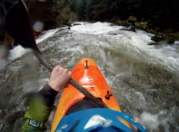
Cruising boulder gardens (Photo: Bryon Dorr)
Trout creek starts and finishes with some class IV boogie water, with the steepest of rapids in the middle mile. Wood is a known hazard on this run, so as always, be cautious of new wood on such a run, as the creek bed is ever changing.
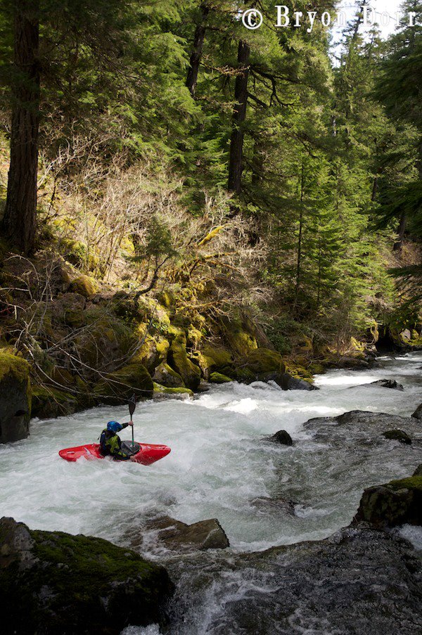
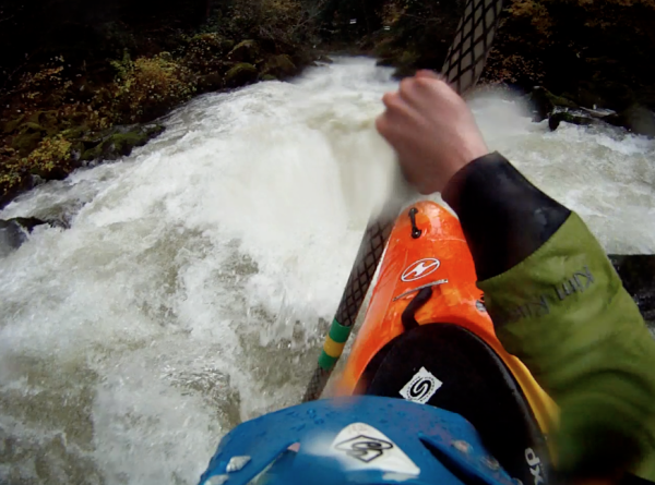
Entering one of the first rapids of the day
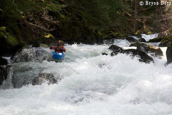
Joe Stumpfel in the middle of it (Photo: Bryon Dorr)
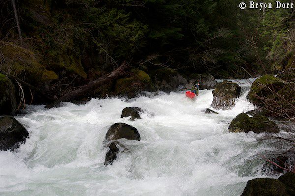
One of the larger rapids near the bottom of Upper Trout (Photo: Bryon Dorr)
If you decide to check out this creek, as around for local beta re: wood, hazards, snow/water levels and road conditions. Be prepared for some full-on, quality rapids, and remember to bring your pin kit!
Thanks Bryon Dorr of Exploring Elements for the photos! Bryon Dorr captures travel through an adventure sports lens and can be found on the road exploring the elements. For more information, please visit his website.
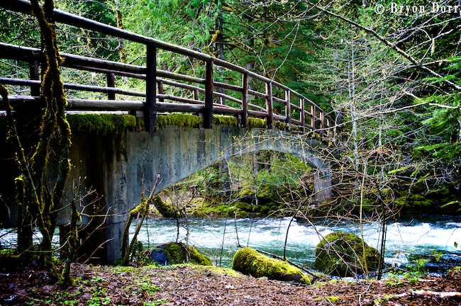
To get to the take-out: Head to Stabler, WA, and make a left on Hemlock Rd. Continue another 3/4 mile or so and take a right on FR 43. Continure on FR 43 until you reach a pullout where the Pacific Crest Trail crosses Trout Creek on your left.
To get to the put-in: FR 43 follows the entire run. The standard put-in is at the bridge about 4 miles up FR 43 where the road crosses Trout Creek. This put-in allows for a mile or so of class II/III for a warmup. As an alternative, it is possible to pull over at the first major pull out on the left side of the FR 43, and hike through the woods to the creek. This will put you on the river right as rapids start to steepen up. If you’re not sure where exactly you want to put-in, drive up toward the bridge on FR 43 as far as the snow allows, and put-in.